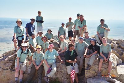
Troop 761
Philmont Crew 701-G1 and G2
Itinerary 12 – Day by Day
In 2006, Troop 761 of Thousand Oaks, California, sent two crews to Philmont Scout Ranch in New Mexico.
 Crew 701-G1
Kyle J. – Crew Leader
Anthony T. – Chaplain Aide
Brendan C.
Anthony D.
Alex K.
Shane K.
Mike Kennedy – Lead Advisor
Joan Cicchi
Larry Tuck – Contingent Coordinator
Lisa Tuck
Crew 701-G2
Andrew S. – Crew Leader
Sam D. – Chaplain Aide
Mike B.
Jaime C.
Jack H.
Devon L.
Kiel L.
David M.
Jim Meyer – Lead Advisor
Jaime Cotto Sr.
Loren Dacanay
Jeff Lewis
Here’s a day-by-day breakdown of our trek, with approximate mileages and elevations (elevations of key points are in italics.)
Thursday, 6/29/06 – Amtrak: We met at Holy Trinity at 1 p.m. for a final pack check. Then we loaded up and headed for the Moorpark train stop, where we caught the Metrolink train departing at 2:30. Metrolink took us down to Los Angeles Union Station where we would connect with our train to New Mexico, the Amtrak Sout
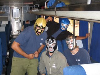 hwest Chief. After taking our packs to the baggage room, we walked a couple of blocks to Olvera Street and had Mexican food. There are a lot of souvenir stands and several of the Scouts bought Nacho Libre-style wrestling masks, which frankly I found rather alarming – I asked them not to wear them while we were walking around the station -- they were scaring the civilians. We boarded at about 6:30. The train pulled out a few minutes later and we were on our way. One problem: Mr. Lewis, who had to go in to work that morning, had missed the train. After a few hours of consideration he decided to drive out and meet us at Philmont Saturday morning.
Another group of Scouts, from a troop in Mission Viejo, boarded in Fullerton. There are 21 of them, two crews, and they are doing Itinerary 13, which overlaps our route in a few places, so we will be seeing them on the trail.
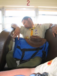
Things gradually quieted down as we headed east. Many of the boys stayed up most of the night, hanging out in the lounge car or in the lower-level baggage compartment, where the Mission Viejo troop had stowed their packs. The adults tried to sleep, with varying levels of success.
Friday, 6/30/06 – Amtrak: I gave up trying to sleep around 4 a.m. and walked down to the lounge car to check on the Scouts. When I told them what time it was they wrapped up their card game and went back to their seats. I sat up in the lounge car
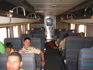 for a while, watching the sunrise as we passed through Flagstaff, when got a cup of coffee. After Flag it’s a pretty monotonous ride across the desert. People read, played cards and portable video games, listened to MP3 players, dozed. Jim Meyer, Lisa and I went down to the dining car later in the morning for breakfast and were seated with an interesting gentleman who was traveling with his grandson. He is a physics professor at a university back east. The train stopped in Albuquerque around lunchtime and I was looking forward to getting off there and buying something to eat, but the street vendors who were there in 2001 are mostly gone; the station has since been remodeled and upgraded into a “transportation center” and I guess the parking lot vendors were not upscale enough for the new image.
We arrived in Raton just a little behind schedule, shortly after 5:30 p.m. Two Philmont buses were waiting for us. The bus driver offered to stop at Dairy Queen for dinner, and we took him up on it. The Mission Viejo group got to the welcome center just ahead of us and were assigned the last trailbound tents, so we got to pitch our trail tents in the “meadow” for the night.
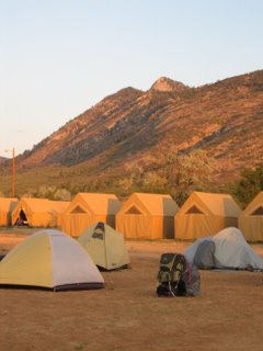
Philmont Day 1 (Saturday, 7/01/06) – Camping Headquarters: Our official first day at Philmont, hence our Expedition number 701-G, which means we were the seventh group to make a reservation for 7/01. After breakfast in the dining hall, we went to the Welcome Center for official check-in and met our rangers. G-1’s ranger was John Fischer, a college student from Indiana. He has been on a couple of treks and is a second-year ranger, and seems like a good guy. Turns out he knows Kristina, our daughter, who is camp director at Miners Park, one of the backcountry staff camps.
The rest of the day was the usual round of check-in activities. All of the adults on our crew passed the med recheck with no problems, though a couple of the adults on G-2 had high blood pressure on the first try and had to go back for a second check.
Day 2 (Sunday, 7/02/06) – CHQ to Old Abreu (2.5 miles hiking): Up early for breakfast, locked the last of our personal gear and Class A’s in the crew locker, then caught the bus for the drive down to Zastrow turnaround (6900 ft.). After initial
 training (map and compass review, use of the Red Roof) we hit the trail. A new trail leads directly into Zastrow Camp, formerly site of Wood Badge training at Philmont (the course is now taught at PTC since the advent of the new syllabus). We stopped there and the boys decided to stay a while for program. Lisa, Mike Kennedy and I, all Wood Badgers, were interested to see the cabin and chatted with a couple of staffers about the Wood Badge program while the Scouts did the GPS course. Then we followed the river upstream, passing through Rayado River trail camp before coming to (New) Abreu Camp (7180 ft.). This is a staff camp with a Mexican Homestead theme. It started raining – pretty hard, in fact – shortly before we arrived. We ate lunch under a tree, then went up to the cabin and did the tour. The boys were intrigued by the idea of milking goats, so we tentatively decided to come back for program after dinner. After hanging out a bit longer – some of the guys bought root beer at the cantina – we hiked on to Old Abreu Camp (7560 ft.).
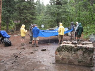
Old Abreu used to be a staff camp until the mid-60s when a flood devastated the area. After that, the staff camp was moved to its current location at New Abreu. Old Abreu is now used as a trail camp. You can still find masonry foundations and other vestiges of when this camp had buildings. John taught the Scouts how to set up a dining fly and hang bear bags. I especially like his mnemonic for trying a lark’s head: “make an alien head, punch the alien in the face, reach in and pull his guts out, yelling ‘welcome to Earth!’” He cooked dinner for us – the same “stir fried beef and vegetables” with ramen noodles that we had on one of our training hikes. After dinner we went back down to Abreu for advisors coffee and goat milking. It rained on and off overnight.
Day 3 (Monday 7/03/06) - Old Abreu to Crags (3.9 miles): The first part of this day’s hike involves a fairly steep climb and it is in the open. We were pretty slow getting out of camp – not on the trail until 8:30. The trail switchbacks from Old Abreu up onto the rimrock (1 mile, 8200 ft.). The top of this bluff is the southern boundary of Philmont. After about a mile climb it’s a fairly level trail that runs along the contour line near the top of the canyon wall, all the way to Fish Camp. We detoured about a helf mile out of our way to Carso
 n Meadows, a new camp since 2001, where the program is search and rescue. Our crew and G2 did a simulated search and rescue mission here. We got some rain at Carson Meadows and again in the afternoon.
The hike above the Rayado River is considered to be one of the most beautiful on Philmont, with interesting rock outcroppings and great views of the river canyon and the mountains to the north. A few miles up the canyon a side trail drops down to the river and Crags Camp (8020 ft.). This is a small camp only used by one or two itineraries and it was just us, G2 and one other crew – a PTC Mountain Trek crew, I think. For a short day, this was kind of a struggle, as we still didn’t quite have our act together. Some of the adults were carrying more then their share of the load, and having a hard time as a result. We hashed some of this out at Thorns and Roses.
Day 4 (Tuesday, 7/4) – Crags to L
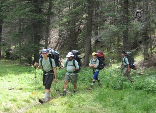 ost Cabin (6.9 miles): We got an earlier start today and continued west, upstream. We made excellent time as the crew began to work together and set a good, steady pace. We arrived at Fish Camp (8550 ft.) about 9:00. We toured Waite Phillips' fishing lodge and learned fly tying and casting. Since we had plenty of time, a couple of the Scouts borrowed rods and tried their luck at fly fishing. After lunch we continued up the Agua Fria River (the Rayado and Agua Fria join at the cabin). After passing Agua Fria camp the trail climbs up onto the flat on the north side. Some call this short, steep climb the "Seven Switchbacks from Hell" (8960-9240 ft.). We got some rain along the way after Fish Camp. After we got to the top it was a short hike to the east to Lost Cabin camp (9200 ft.). I did a little recon and found the cabin ruins on the hill above the campsites.
Day 5 (Wednesday, 7/5) – Lost Cabin to Beaubien (7 miles): Getting an early start we hiked over to Apache Springs to have a look around. Took the tepee “tour” and did corn grinding – unfortunately archery was booked up for most of the day. From Apache Springs
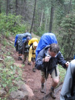 , we decided to head north through Bear Canyon and Buck Creek Camp. We got to Phillips Junction, a little after noon, had lunch, then picked up our next supply of food. We were a little concerned, since we had a 3:00 appointment for horseback riding, so we loaded up our food quickly and left for Beaubien about 1:30. Made the hike to Beaubien (9340 ft.) in just about an hour.
Beaubien, one of Philmont’s three western lore camps, offers several programs, including horseback riding, branding, and an evening campfire with songs and stories. For those old enough to remember the old TV series “Bonanza,” this is what the Ponderosa Ranch would have looked like if it was a real place. It’s a busy camp, and after the last few nights in trail camps seemed crowded.
We made it with about 15 minutes to spare, rushed through our porch talk and then scooted over to the corral for riding. After the ride we got our campsite assignment late, and didn’t finish dinner in time to catch any of the evening program, but that’s okay since we had two nights here.
Day 6 (Thursday, 7/6) - Beaubien layover d
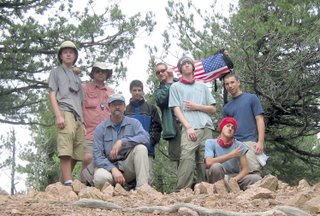 ay: We decided to do the side hike to Trail Peak (8 miles round trip, 10,240 ft.) since we already did our horse riding. The wreckage of an old army plane from the 1940s is scattered along the top half of the mountain. Tough hike up for some of us old guys but worth the effort. We reached to top in plenty of time for lunch. G2 arrived a bit later and I took a picture of them on the peak, then we headed back down. We had time in the afternoon for showers – cold, unfortunately, since the heater at Beaubien is wood-fired and the fire ban was still in effect. Then chuckwagon dinner, advisor coffee (crowded) and the campfire, which everyone agreed was very good. We got lucky and there was no rain this day, so we were able to wash some clothes and get things at least semi-dry.
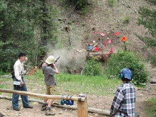 Day 7 (Friday, 7/7) – Beaubien to Black Mountain (2.6 miles): A short hike today, over a low ridge and down to Black Mountain Camp (9040 ft.). Black Mountain Camp is the most isolated staff camp on the ranch, nestled in a small, narrow valley at the base of Black Mountain. This was one of our favorite staff camps in 2001 and again this year. There are no roads leading into camp -- supplies come in on burros and the only water is from the stream. The theme has changed since 2001. Staff members here used to dress like mountain men; now it’s a Civil War era U.S. Army post and they wear uniforms. The program is the same: black powder rifle shooting, blacksmithing and other back-country crafts. After advisor coffee, the evening program was marching, which was a hoot, and a very sharp flag retirement. Light rain around dinner time then heavier rain overnight.
 Day 8 (Saturday, 7/8) – Black Mountain to Lamberts Mine (7 miles): We got a low start again today, at least partly because of the wet from the previous night’s rain. This is a long day but as in 2001 we found it was not as bad as it looks on the map. We hiked up the stream valley toward Comanche Pass, about 1,400 feet of elevation gain in the first three miles, followed the 10,400 foot contour for a couple of miles along Comanche Ridge, then dropped down into Lamberts Mine Camp (8960 ft.), a trail camp with a few scattered signs of long-ago mining activity. After setting up camp in the rain we fixed dinner for lunch then hiked over to Cyphers Mine (9150 ft.), about a mile and a half away, for program.
Program here includes a tour of an old mine shaft, blacksmithing again, and gold panning. Unfortunately we got there too late to get in for the
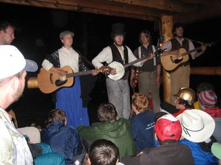 mine tour – the next available time was 9:15 the next morning. I was worried that the boys would be bored but they amused themselves panning for gold (no luck). It started raining again and the staff let us eat our lunch-for-dinner on their porch, then have advisor coffee. I am glad we stayed for the “Stomp,” which is deservedly legendary among Philmont evening programs. A few corny jokes, but mostly a lot of enjoyable bluegrass and folk music, capped by “I Don’t Mind,” my favorite Philmont song, written by a Cyphers staffer about 10 years ago. By then the rain had stopped and we had a nice walk back to Lamberts under a full moon.
Day 9 (Sunday, 7/9) – Lamberts Mine to Cimarroncito (7.8 miles): Since we missed the mine tour the day before, we hiked over to Cyphers first,
 then left there about 11:00 and hiked south along the North Fork of Cimarroncito Creek. Incredibly beautiful hike through a narrow canyon with many small waterfalls and multiple creek crossings. It’s rocky however and a couple of us had sore ankles by the end of the day. We got a spattering of rain along the way. Arrived at Cimarroncito (8160 ft.) about 3:00. This is a busy camp since most central-country crews camp or hike through here. We had already decided to skip rock climbing since our troop does climbing regularly, but we did sign up to do conservation the first them the next morning. Since we arrived fairly late we got stuck out in the boonies at campsite 15. It’s a nice campsite but a real grind up the hill to get there.
Mr. Kennedy, Mrs. Cicchi, Kyle and Brendan emptied their packs and headed up to Ute Gulch commissary to make our next food pickup. The rest of us set up camp. I was pleased how well the crew was working together by this time – little complaining, and everyone pitched in to help. I got a pot of water started for dinner and timed it just right – it was almost boiling when the food crew got into camp. We had dinner then called it a night early.
Day 10 (Monday, 7/10) – Cimarroncito to Cathedral Rock (2 miles): We got up early to do cons at 8:00. Our assignment was cutting down small trees that were encroaching on the meadow just south of Cito, the same
 area where we help build trail in 2001. Our conservationist, a guy called “Buttercup,” gave a great talk and the crews enjoyed the work and felt a real sense of accomplishment.
Afterward, we decided to take it easy – rather then hiking Hidden Valley we hung out at Cito, took showers, then since we had heard there was no later at Cathedral Rock, we cooked dinner for lunch again (the Scouts made this decision and took it in stride). Then we made the leisurely one-mile hike down to Hunting Lodge. There we stopped for the cabin tour – not as good as the one at Fish Camp – and filled up on water. Then another mile down to Cathedral Rock. We and G2 were the only crews in camp and we took the two sites down by the Red Roof. As it turns out, there was water in the creek – not a lot, but enough. It was nice to be able to relax and spend some time talking to the guys on the other crew.
Day 11 (Tuesday, 7/11) – Cathedral Rock to Shaefer’s Pass (4.6 miles): We were up at 5:30, on the trail a little after 7:00. We backtracked a bit to pick up the Clarks Fork trail across
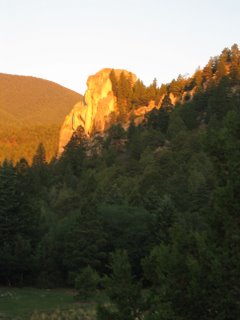 from the reservoir, then north to Clarks Fork, another western lore camp like Beaubien. Saw many deer along the way .We got to Clarks Fork (7530 ft.) a bit after 8:00. We hung out, chatted with staff, played horseshoes and a few kinds did branding. Note that Clarks Fork no longer has a swap box. The cook at Clarks Fork is a middle aged school teacher – Mr. Dacanay and I just looked at one another and said, “we want his job.”
We once again ate our dinner for lunch so we can conserve water later on down (or up) the trail. Most of us carried three or four Nalgene or other quart-size bottles. Instead of bringing one or two larger containers for the crew, each person also carried a Platypus or equivalent collapsible container for dry camps. We filled everything we had at Clarks. We left at 1:45 for the climb through Upper Clarks Fork and Ponderosa Park trail camp to Shaefers Pass trail camp at the top of the ridge (8785 ft.). This is the only change in this itinerary since 2001 – that time, we stayed at Ponderosa Park. Overall, this is a change for the better, since it shortens the last day’s hike. But it did make for a long climb on Day 11.
We reached Shaefers Pass about 4:15. Crew 2 got in shortly after. We hung out, chatted with the other crew, had lunch for dinner. From the edge of the meadow, I spotted Miners Park, Kristina’s camp. After a little wind, it was a very mild night.
Day 12 (Wednesday, 7/12) – Shaefers Pass to Base Camp (8 miles): We wanted to get as early a start as possible today, so we got up at 4:30 and were on the trail at 6:00. We took a wrong turn to start – I should have had the navigator checked the map, but I thought I knew where I was going. We missed the first long switchback up the west side of Shafers Peak and took a “short cut” straight up the hill. As before, the hike along Tooth Ridge is a difficult, rocky hike, and takes longer than you would expect from l
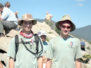 ooking at the map. We had told Crew 2 we would meet them at the base of the Tooth at 8:00 but it was more like 9:00 by the time we got there.
Then a long, rocky scramble to the top of the Tooth of Time (9000 ft.). I was not sure Lisa or I would make it – so I gave the “secret” package I had been carrying to Mike Kennedy with instructions in case I didn’t get to the top. When he got there, he and Loren Dacanay presented Kyle J. and Anthony T., our two newest Eagle Scouts, with their Eagle badges.
A couple of the boys – Sam and Devon – came down to check on Lisa and me, and with their coaxing we finally got to the top.
Back down on the trail, we continued down the seemingly endless switchbacks to Camping Headquarters (6699 ft.). The two crews mostly
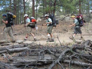 hiked together, setting a fairly brisk pace – but it’s still a long, dry, hot hike. We were wishing for rain by the end. Most people were out of water, or close to it, by the time we got to the bottom. We arrived at base camp about 2:00.
At CHQ we checked in, returned borrowed gear, then hit the showers and put on clean clothes. Lisa and I were hoping to see Kris, but (as we later found out) because of a series of miscommunications we didn’t connect. I was sorry not to see her – and it would have been nice to see Miners Park, as we had talked about – but at the same time I would have felt funny about leaving the crew. Jeff Lewis, who had his car there, drove into Cimarron and bro
 ught back a bunch of pizzas (the shuttle into town has been discontinued, alas). Most people visited the trading post, went to chapel, then we all went to closing campfire. It didn’t take much convincing to get the Scouts to go to bed right afterward.
Day 13 (Thursday 7/13/06) – CHQ and Amtrak: Everyone was up early to finish packing. After breakfast in the dining hall, we made our final runs to the Trading Post, boarded the bus to Raton for our train ride home. Another long weary day on the train. There was a long delay in Albuquerque for a change of locomotives. Turns out there is an ice cream shop (Coldstone) right across the street from the station – wish I had known. All of the adults and a couple of Scouts had dinner in the dining car. After 10 days of trail food the dining car meals were right tasty.
Friday, 7/14/06: We arrived in L.A. just about on schedule and were able to catch the 9:50 Metrolink train, arriving in Chatsworth about 10:30.

1 Comments:
Wonderful journal, Larry. Love the pics. And the boys look like they really loved those goofy masks.
Thank you for sharing your experience.
Cheers
Lorie in SC
Post a Comment
<< Home